Despite being the most prominent and iconic hill in eastern Aberdeenshire, I hadn’t been up here in many years, a bout of decent spring weather coincided with Aberdeen hillwalking club’s trip there, so I made my way down to the bus leaving at a spring-clocks-forward civilised 9am start.
Although the trip had two options, one around the base, one over the top, there’s always a third: “moab.in running about like a dafty off-route looking for photo-treasure in hidden places”. I’d had a look at the excellent and comprehensive Baillies of Bennachie website, which has all manner of interesting facts of the hill, I had every intention of trying to find a few of the lesser known spots. [note Sept 2020 their website has been updated and they’ve not yet added the critical page back in, but fortunately it can still be accessed here: http://web.archive.org/web/20170623073052/http://www.bailiesofbennachie.co.uk/discover-bennachie/]
As such, today’s kit-out was “stealth trail running” Inov8 roclite 290s + gaiters, hagloffs zip-off trousers, allowing for a “hillwalking ready, no raised eyebrows” look, but convertible to high speed heather-n-rocks yomping. A berghaus vapourlite hypertherm went into the salomon jaws rucksack for a bit extra hilltop warmth.
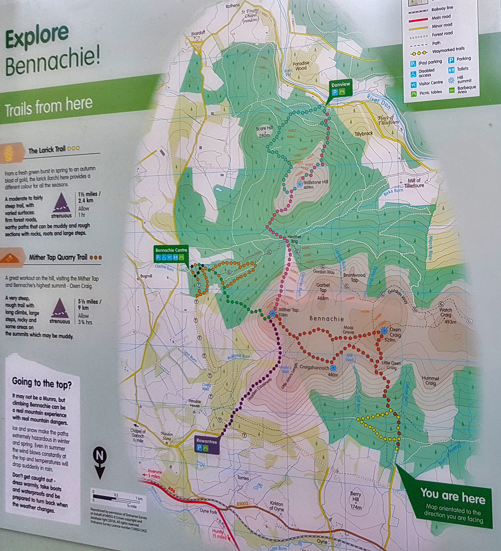
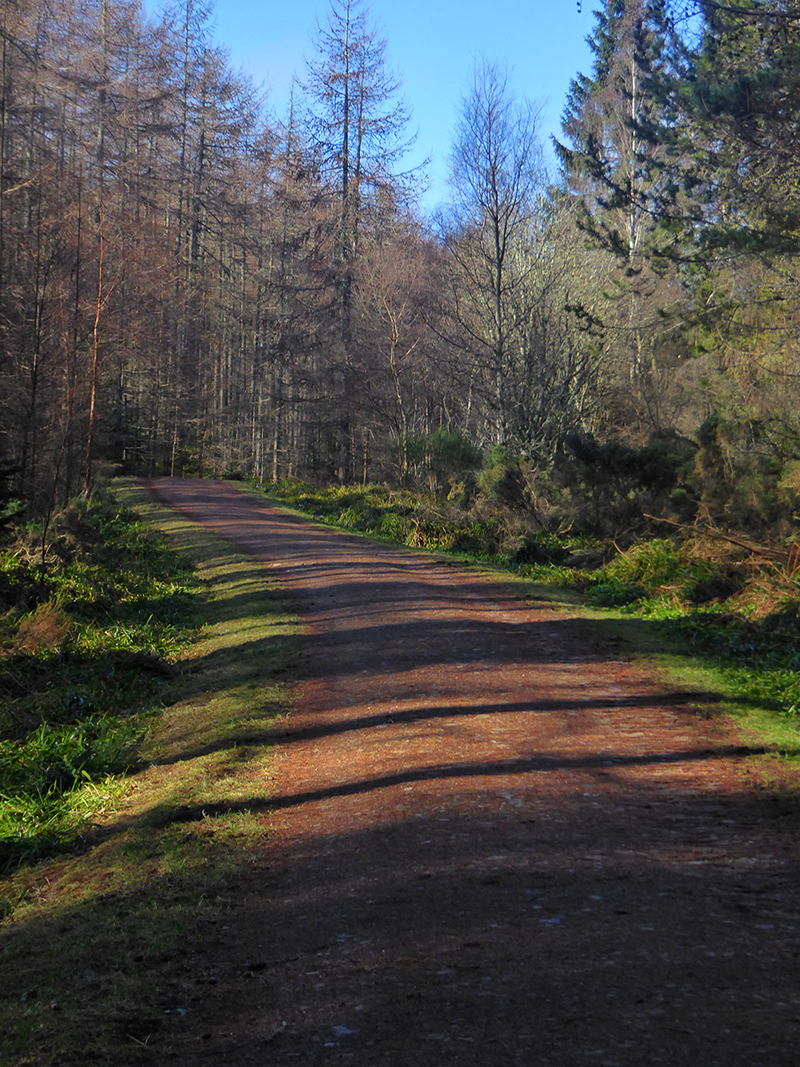
On the bus, I managed to snaffle a forestry leaflet with a map (albeit from 2009). From our starting point at the ‘Back of bennachie’ (also marked on the map as beside Hillford Croft or Puttingstone) there was a nearby sculpture trail. No signposts presented themselves as we set off (later turned out the sculptures were moved in 2013 to near the visitor centre) so although paths headed off into the trees, I marked this down as ‘fail 1′ of today’s exploratory targets. (the map beside the car park is in fact up to date)
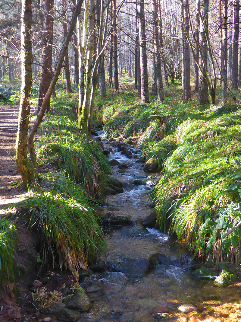
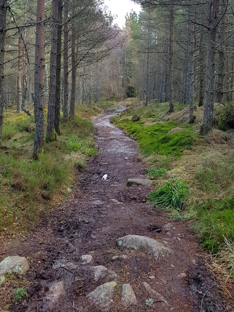
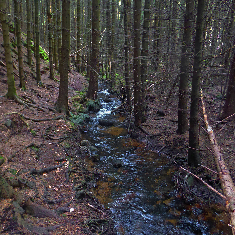
Following the Gillree burn through the woods
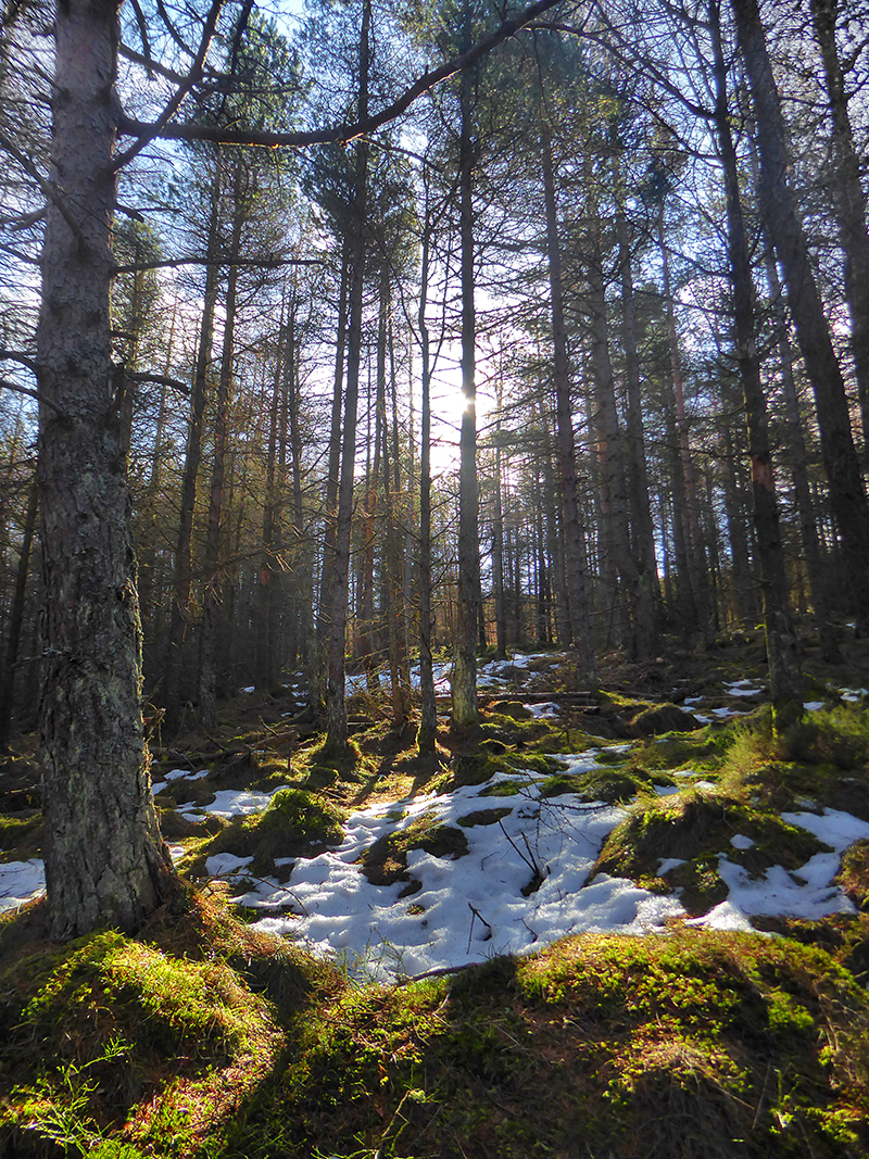
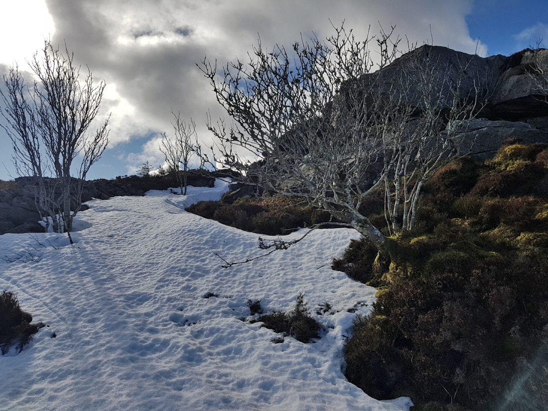
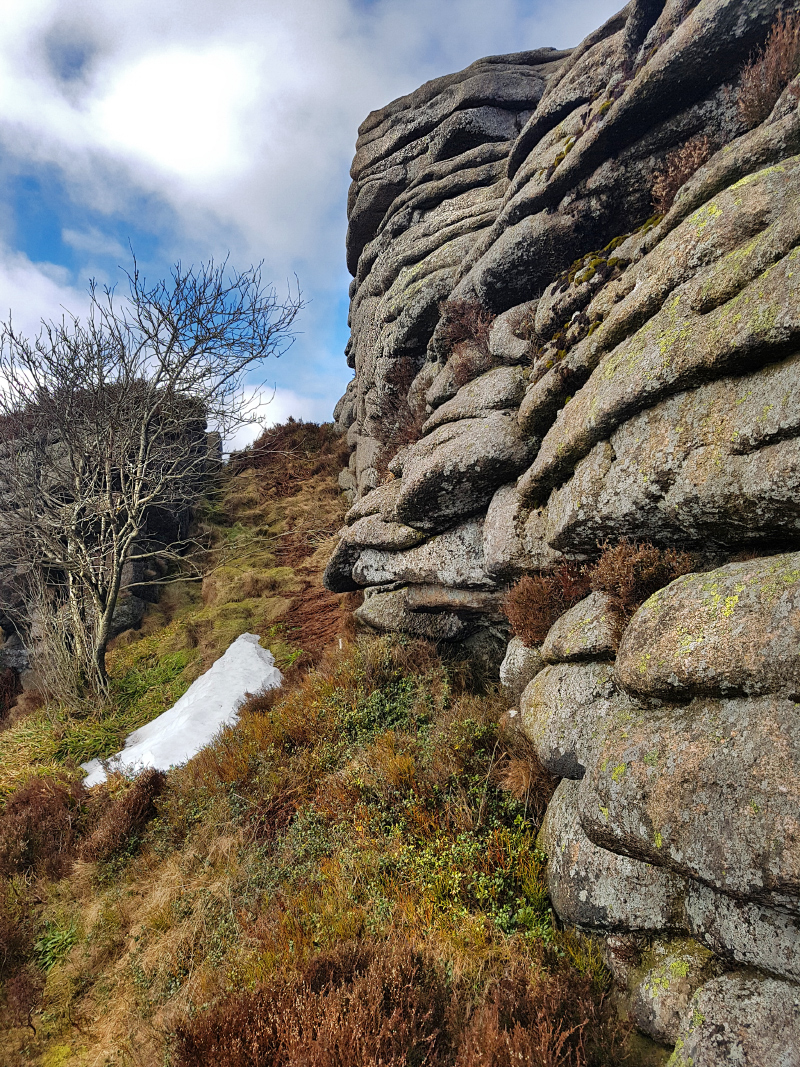
Ascending a bit further, a few banks of snow still lay. Hopefully not too much further up
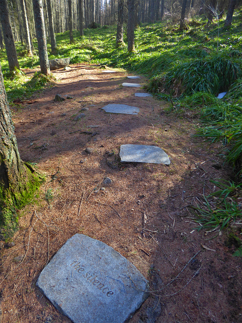
To the left of the path, I noticed a series of slabs with words heading to a seat: The silence of the woodland is the sound of calling birds. Perhaps this is an orphan of the old sculpture trail? Later research shows there should be more hidden amongst the trees: https://web.archive.org/web/20161117150234/http://quitewrite.co.uk/bennachieleitirfura.htm
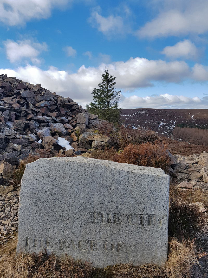
Further discovered info: ‘the tumbling of waters is the taming of life’ is carved into a boulder in the burn nearby, ‘The calling of the Gouk (Cukoo) is the other side of spring’ is in a wall near the gouk stane, and ‘the face of the city’ is at the quarry at little oxen craig
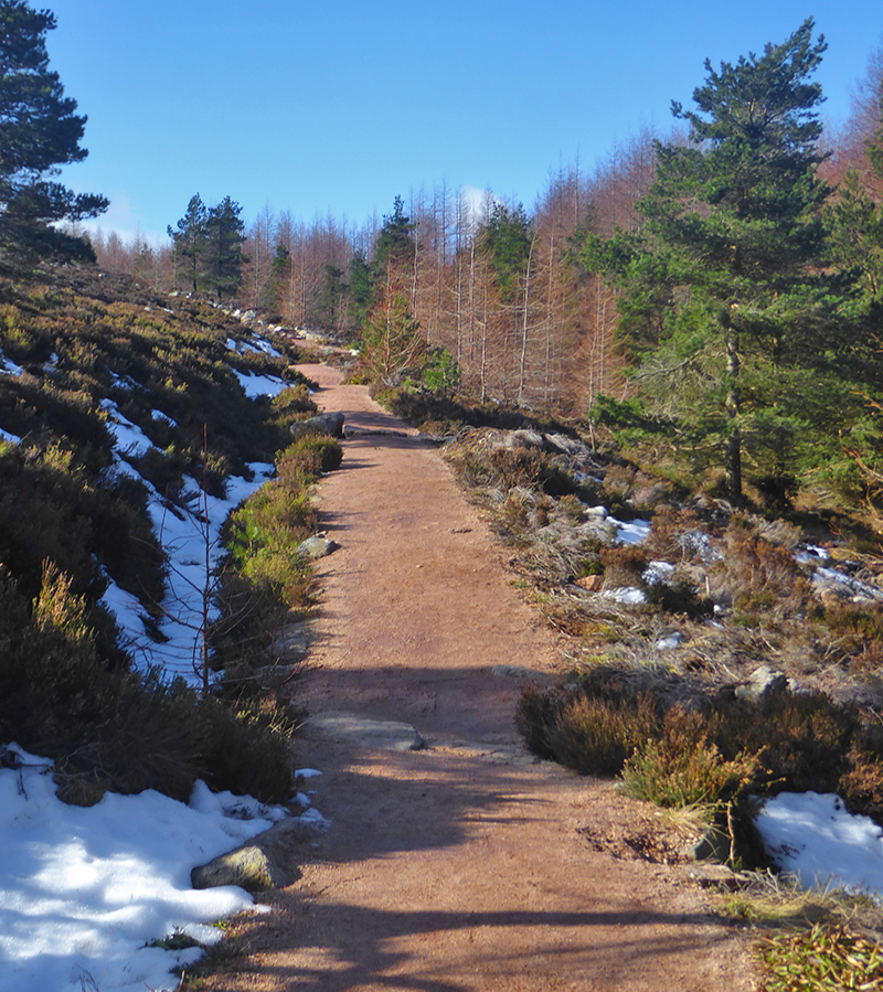
Clearing the woods, a bit more snow but not packed to ice, no real obstacle.
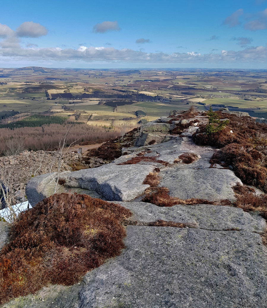
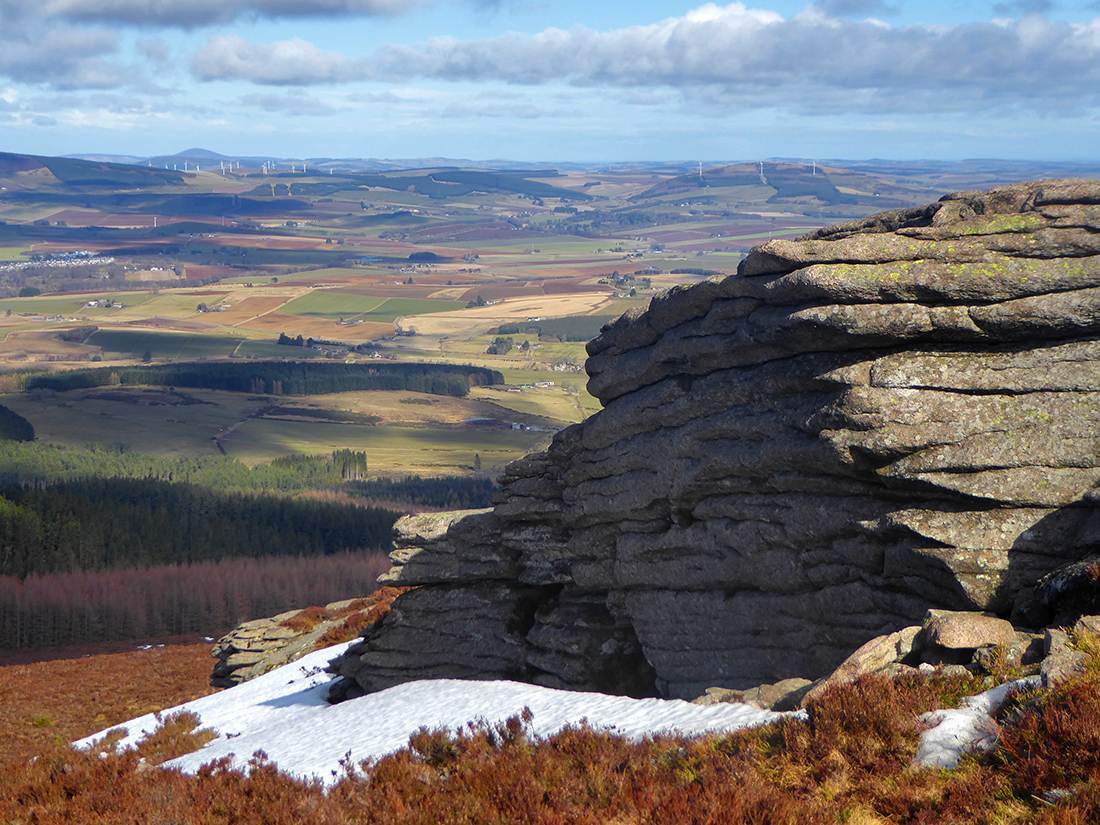
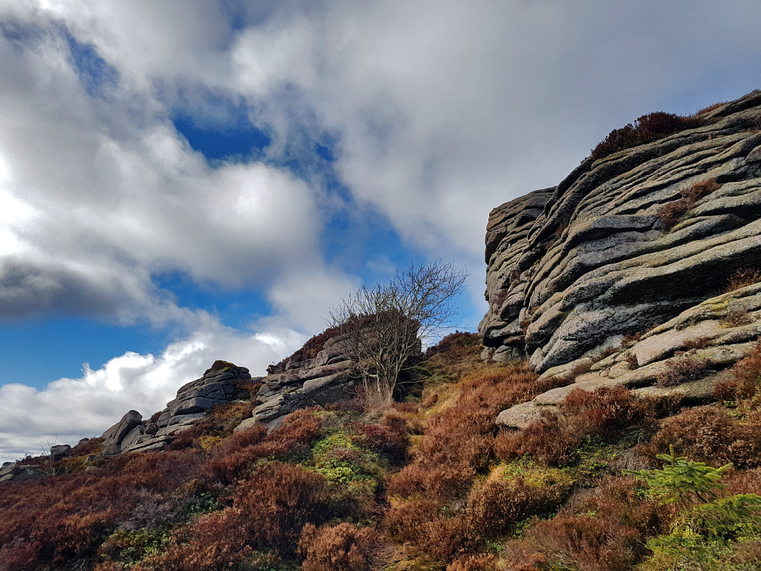
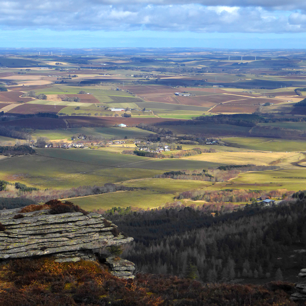
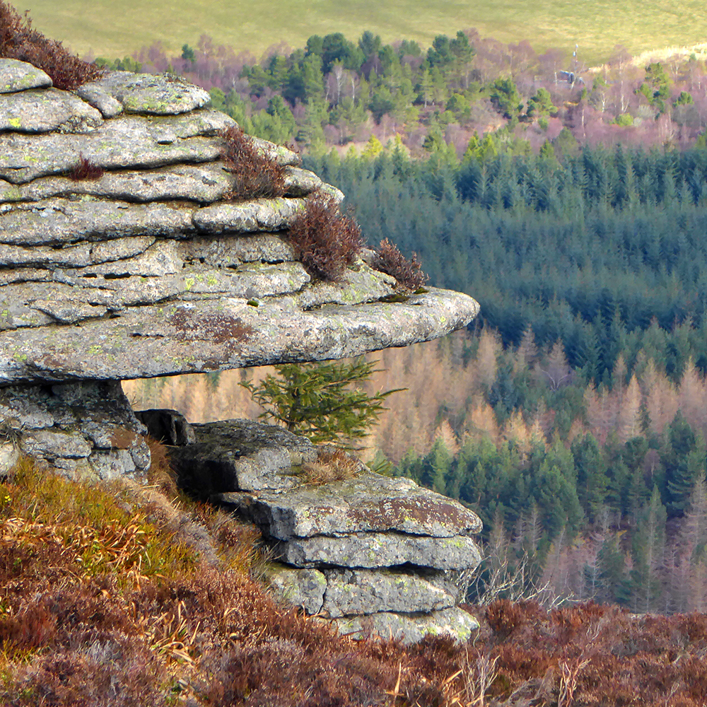
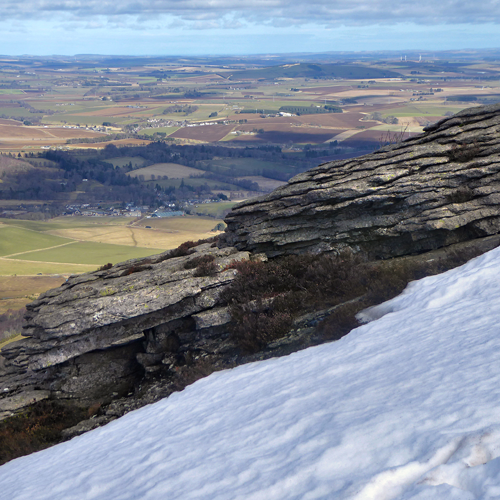
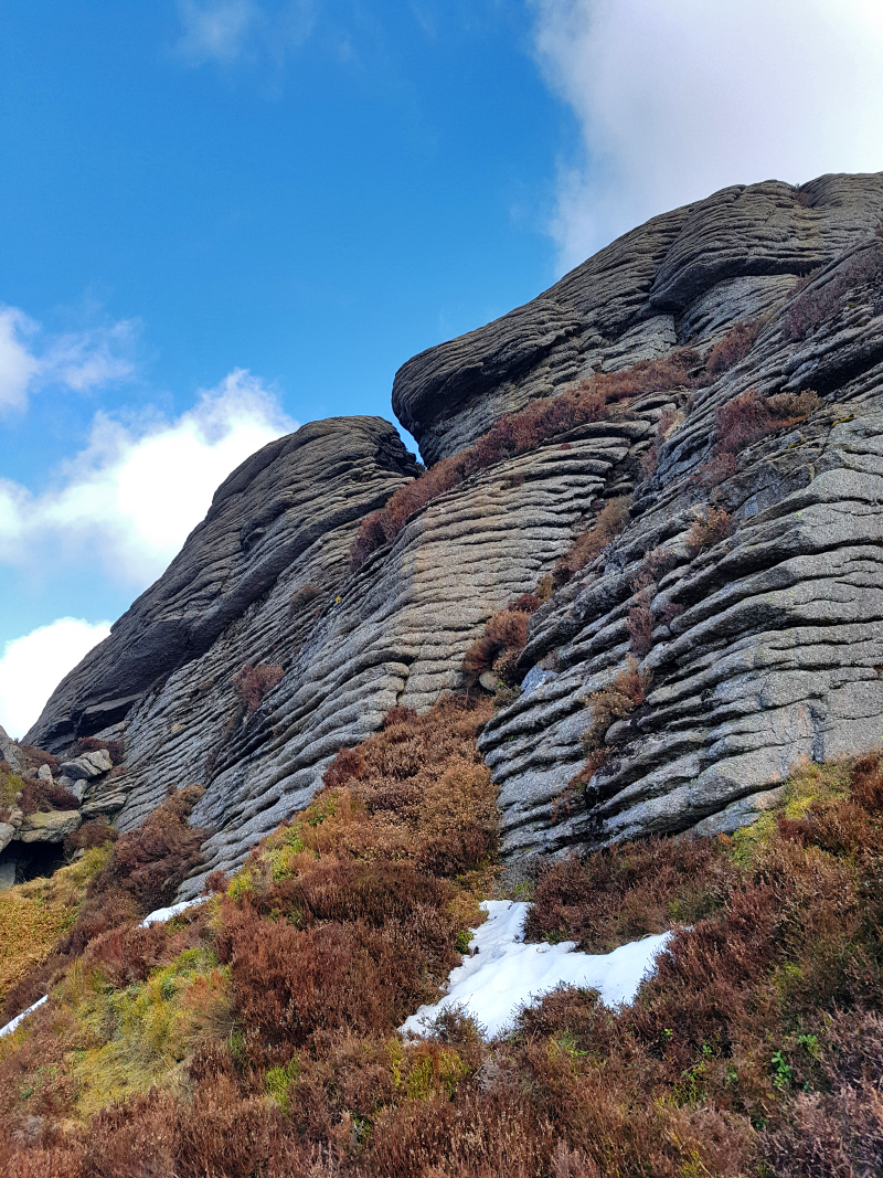
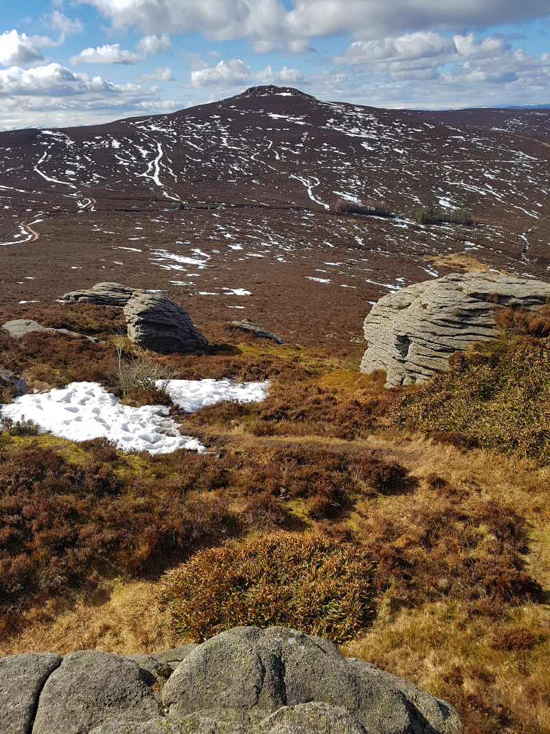
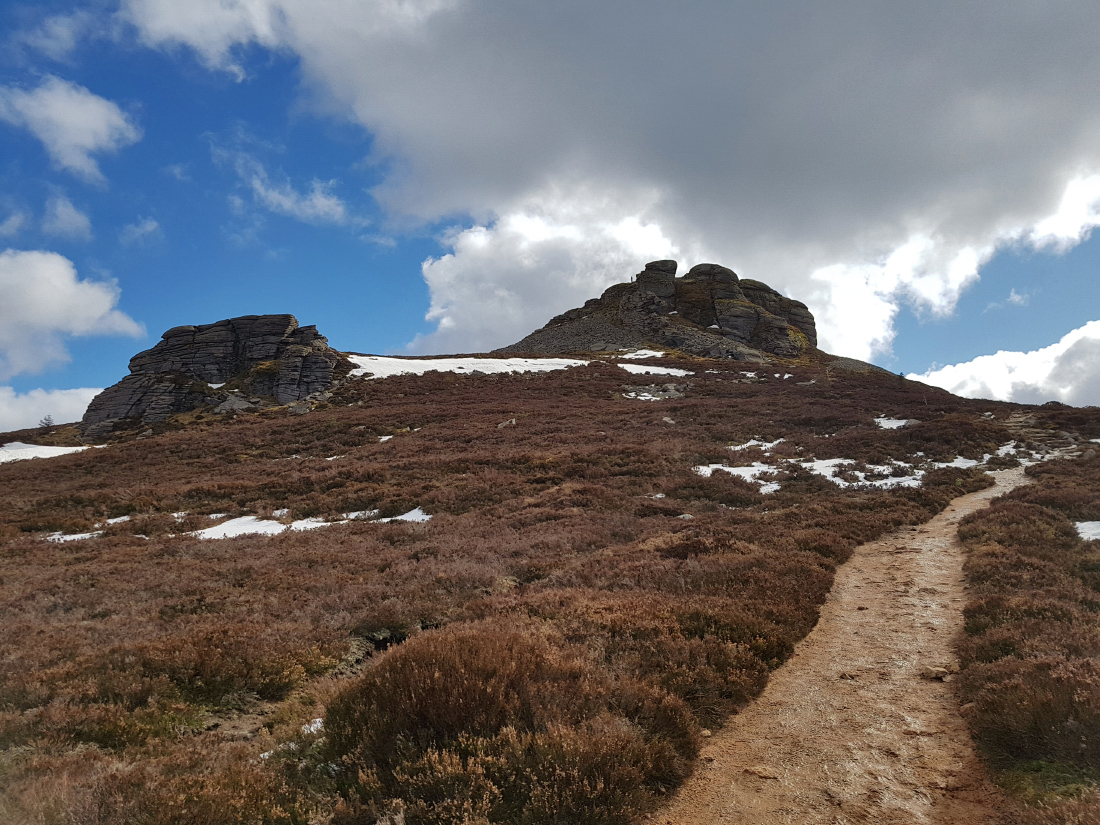
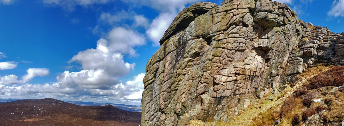
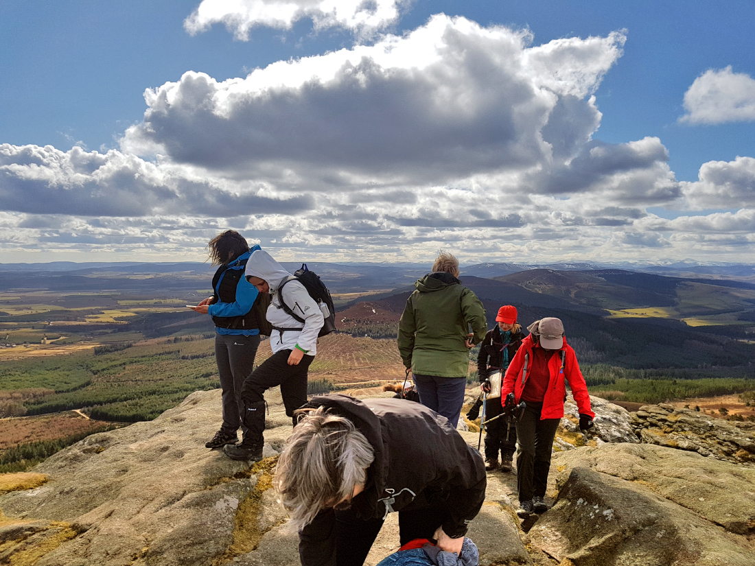
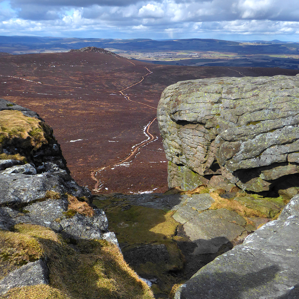
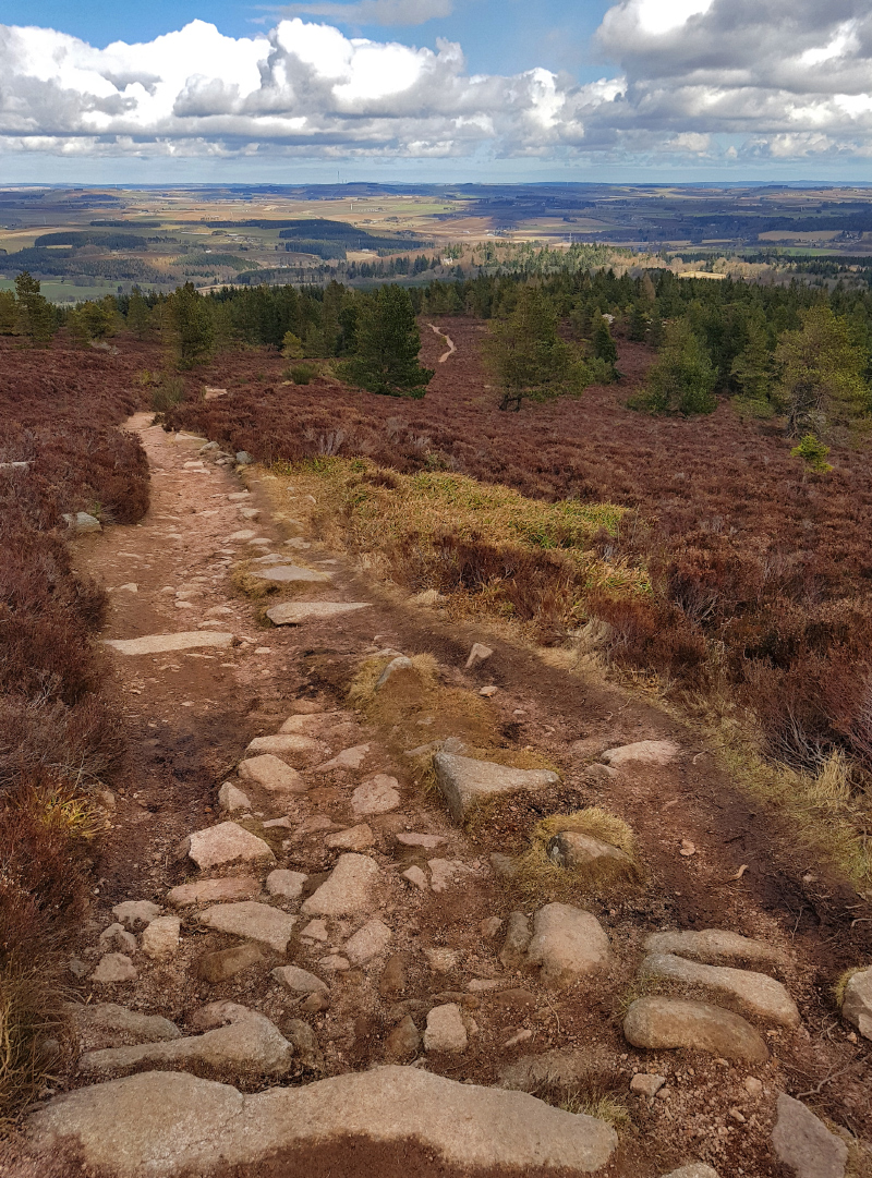
Our first crag of the day – Little Oxen Craig (NJ 663 232, 425m).
There used to be a quarry here in the 19th century. A lovely view, but a tough ‘commute’ every day if you had worked here. According to the Baillies site: “A road from the quarry enabled the stone to be taken to Oyne but in August 1891, what has been described as a waterspout hit the hill in this area washing away the road and leaving a massive ravine. The dressed stones could not be removed and have remained here ever since.” Hopefully Fordyce the builder had other quarries to work, and his men were not made redundant by dint of an unfortunate act of nature.

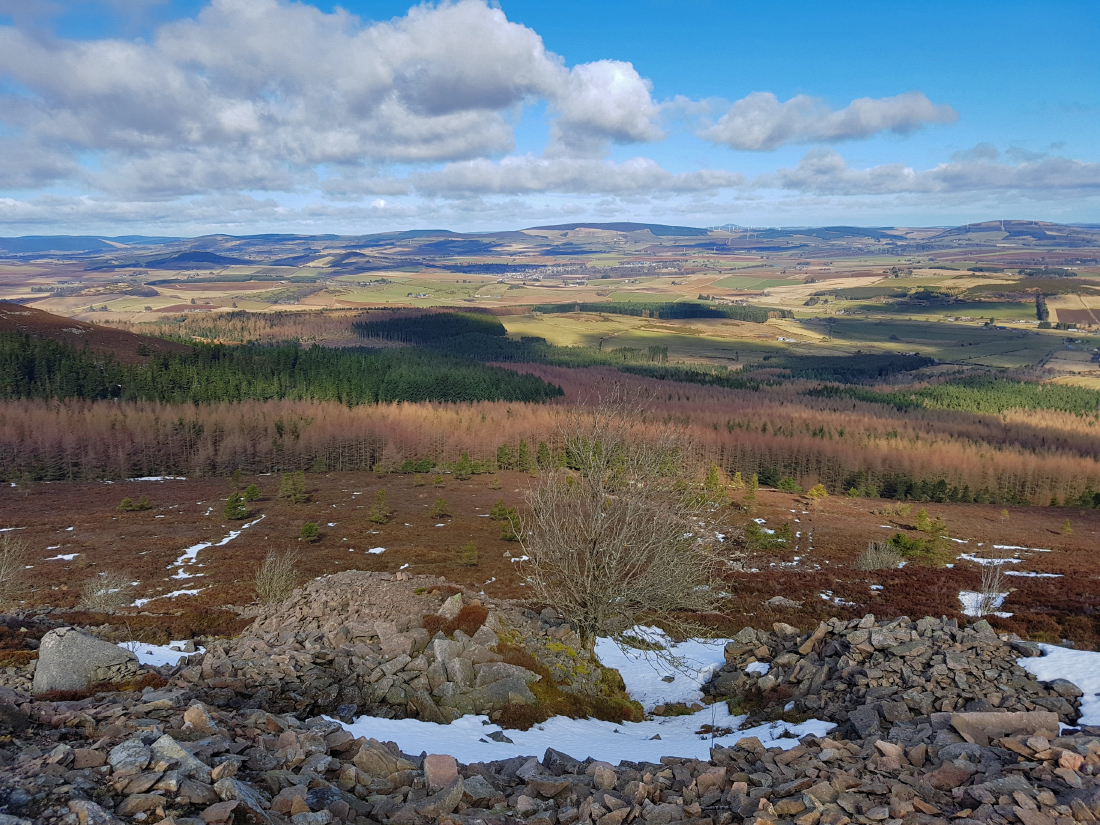
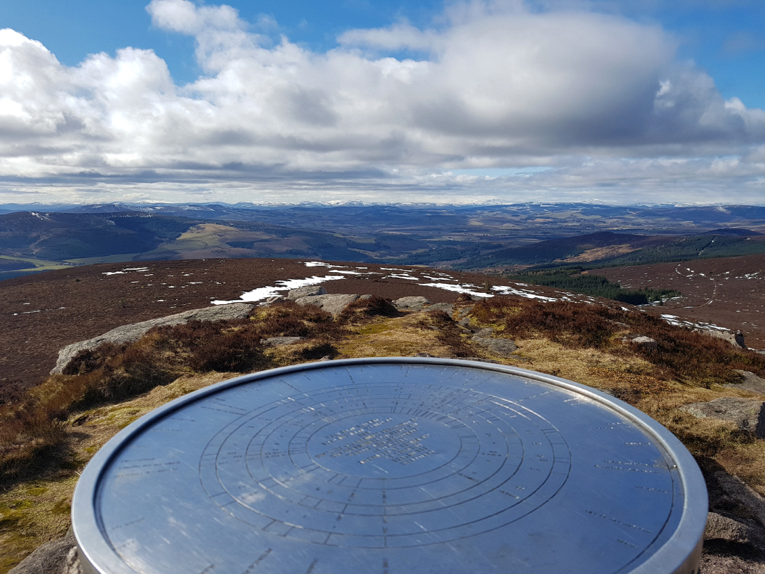
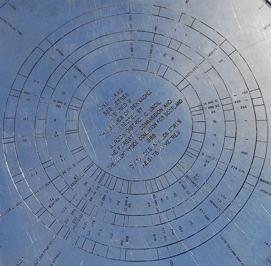
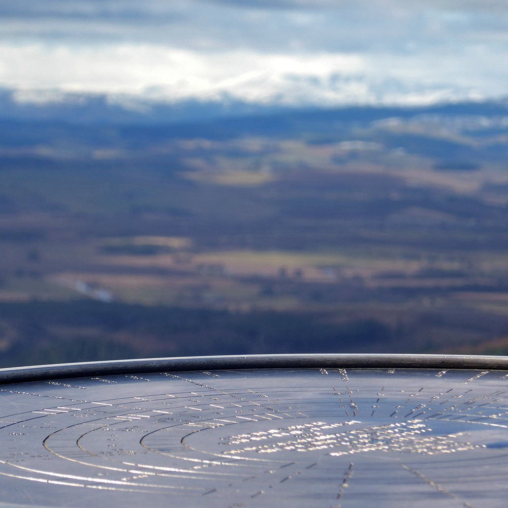
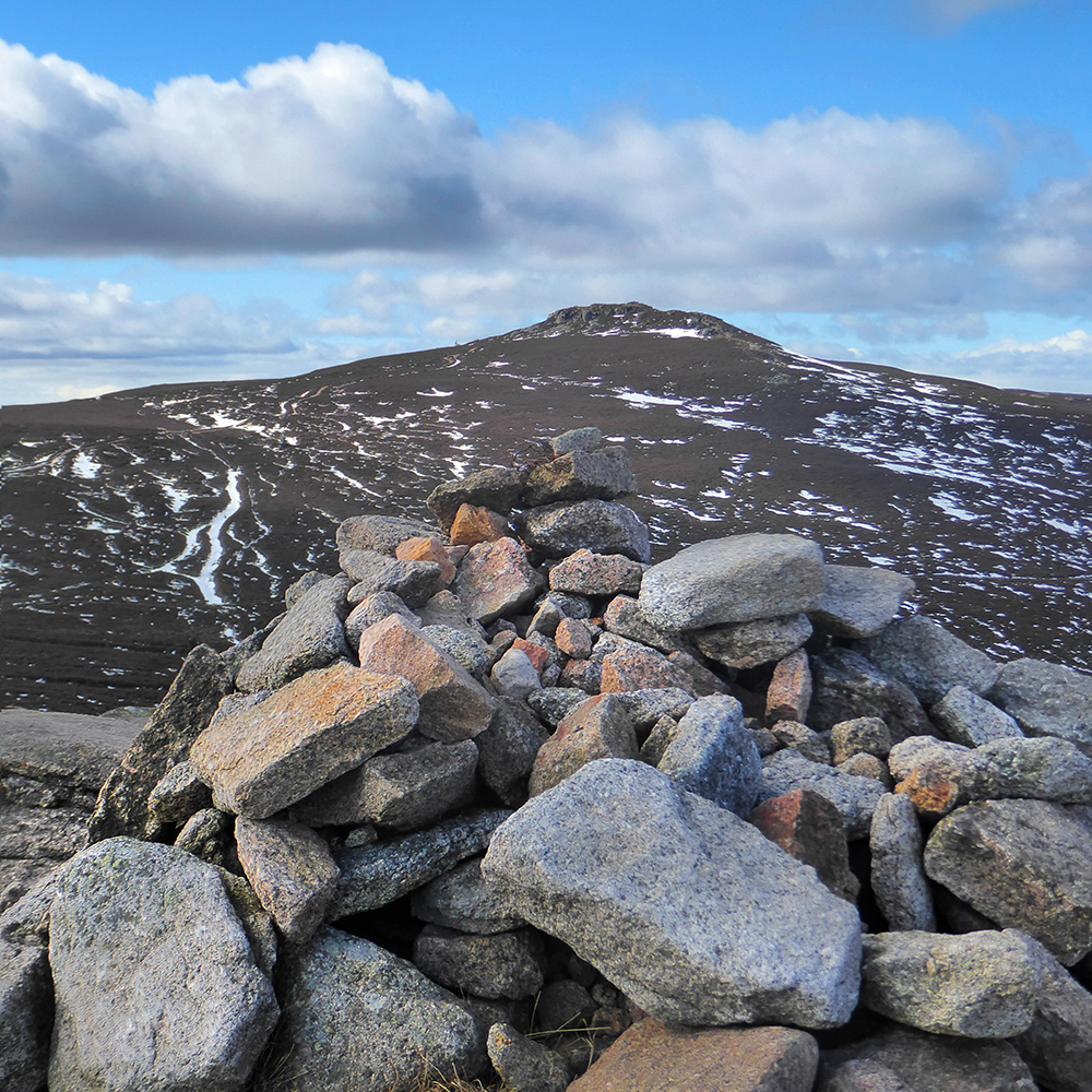
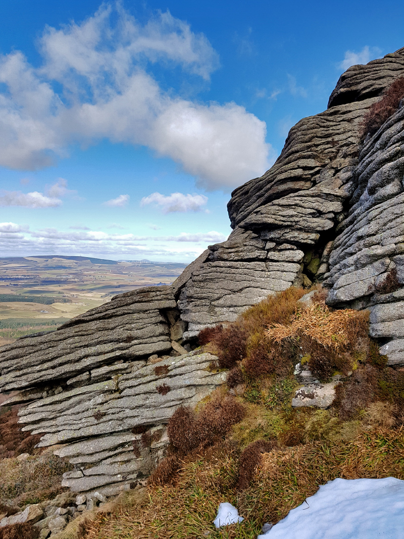
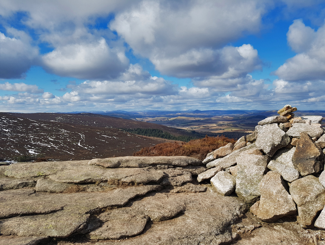
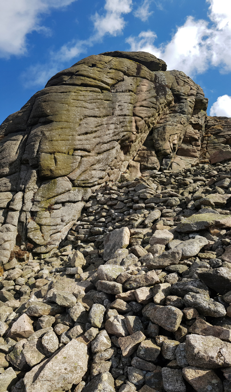
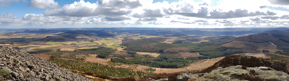
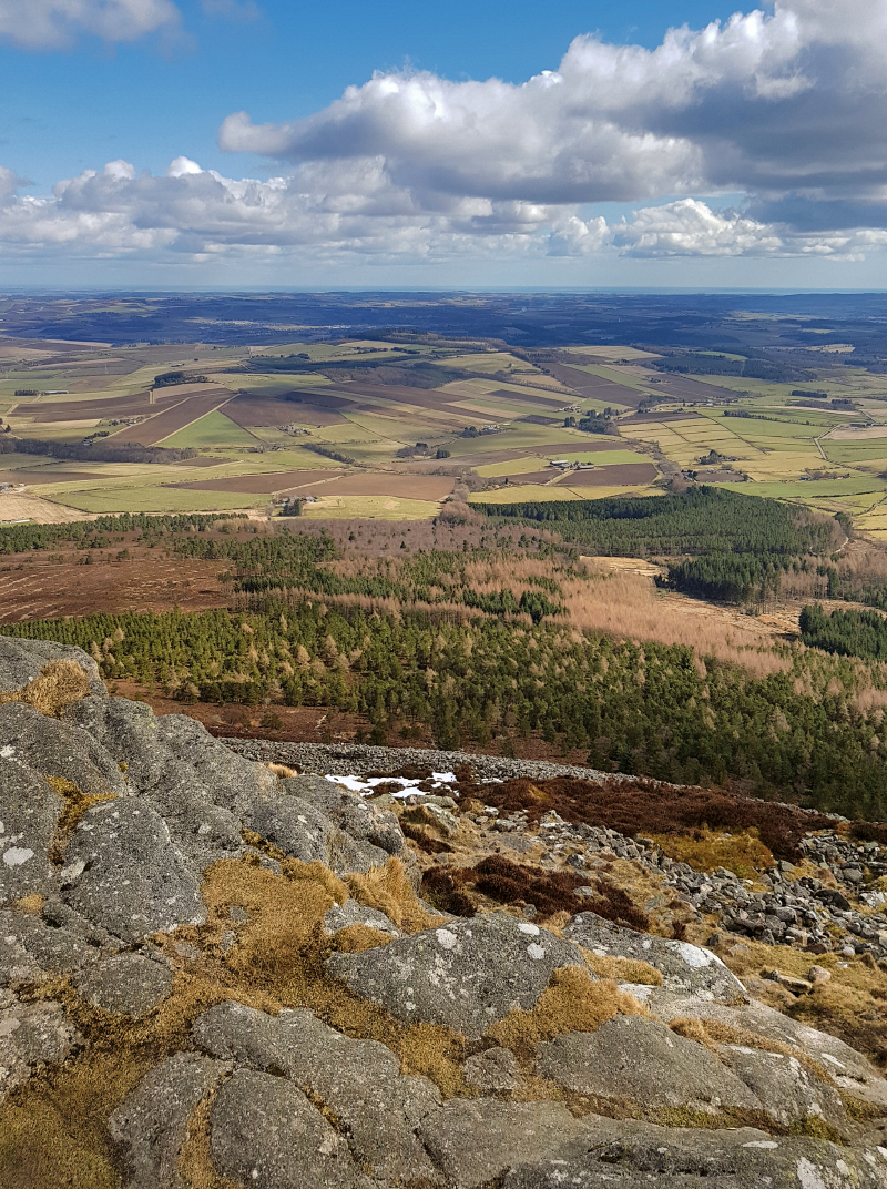
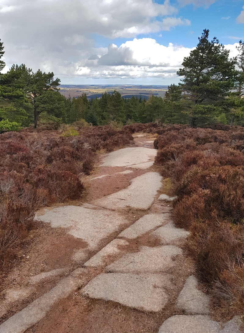
Onwards to Oxen Craig 529. This is the highest point of the range – one would think the more obvious prominence of Mither Tap to have been so, but not the case. A chilly breeze has me putting on the Berghaus hypertherm, just sufficient insulation at rest. A quick snack, and a couple snaps of pleasingly eroded granite, and onwards.

The shelter could probably do with a bit of a tidy

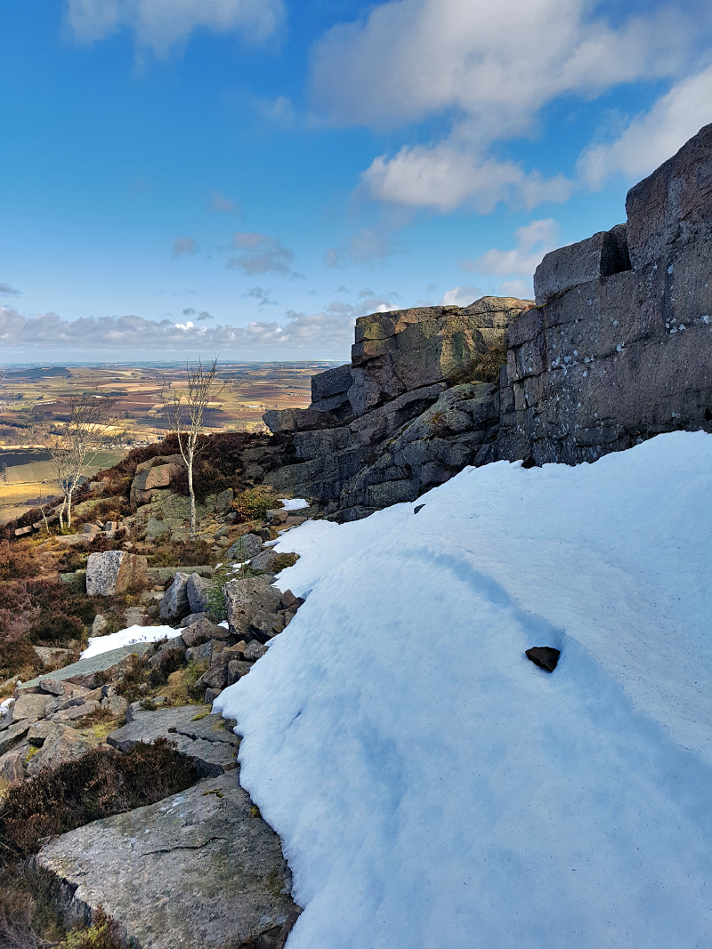
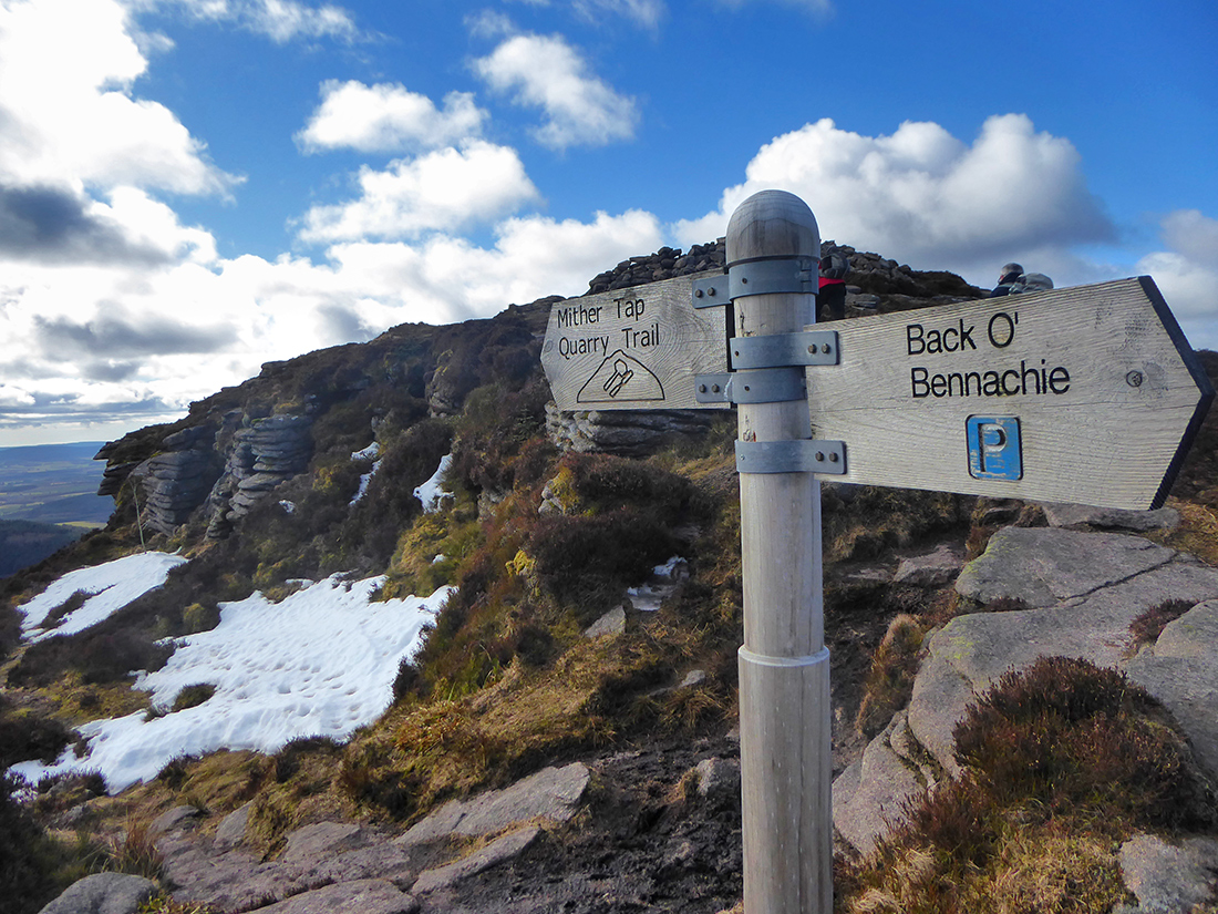
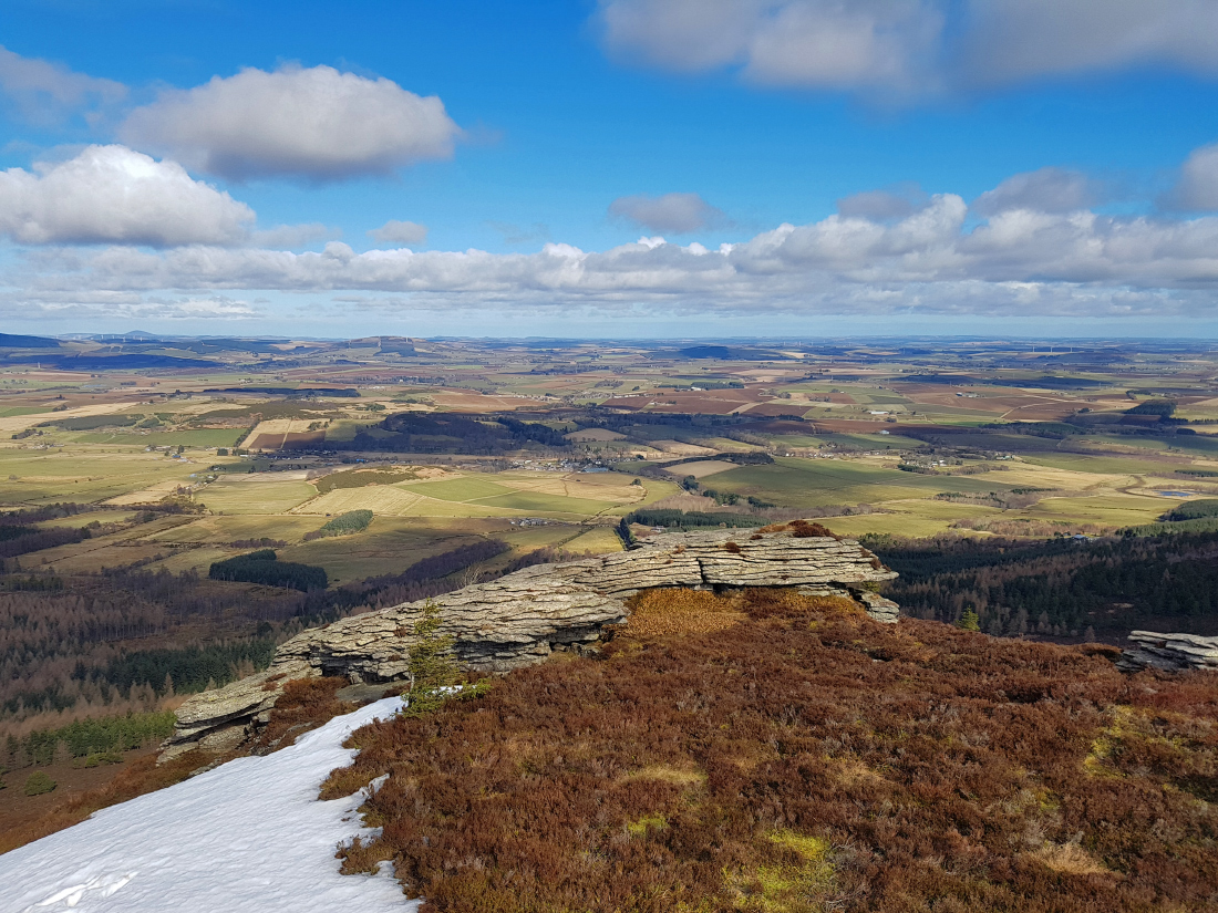
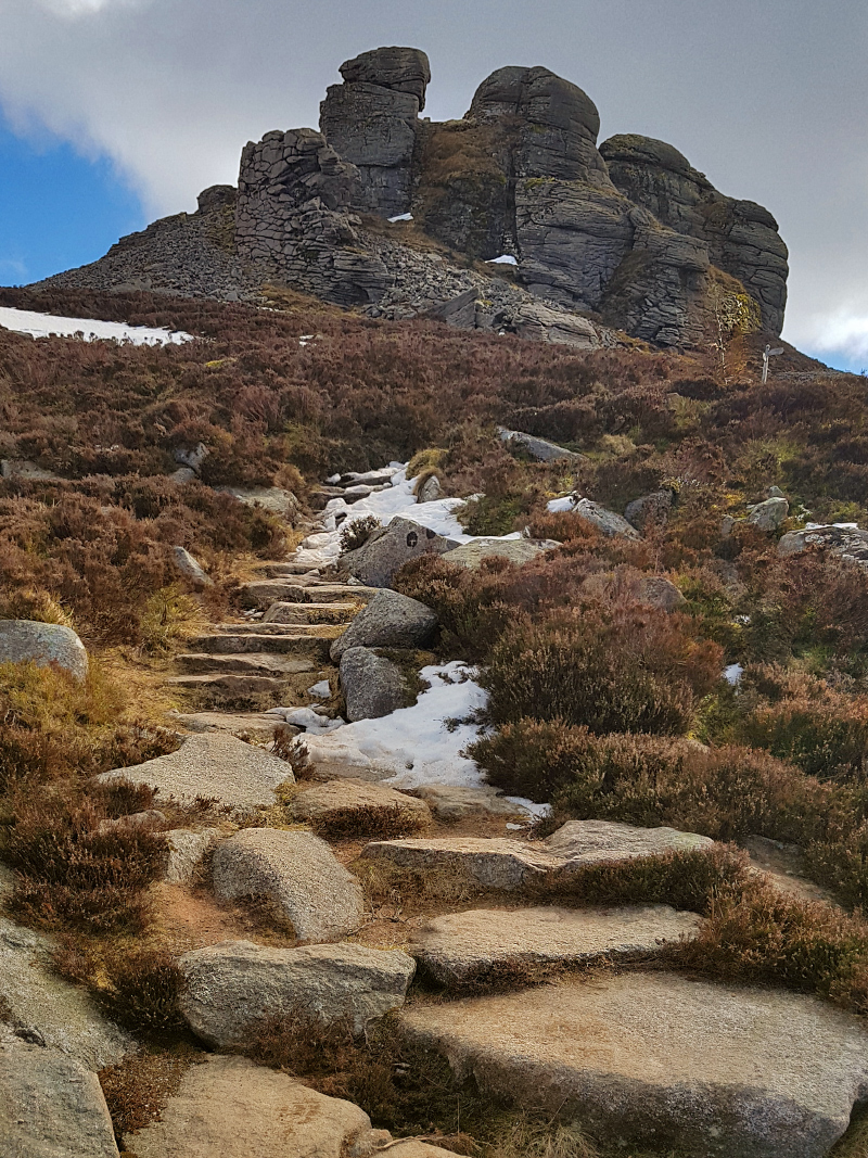
Heading East to Craigshannoch, the paths have a fine filling that is easy on the feet, if a bit dubby from snow melt that can’t drain through it well.
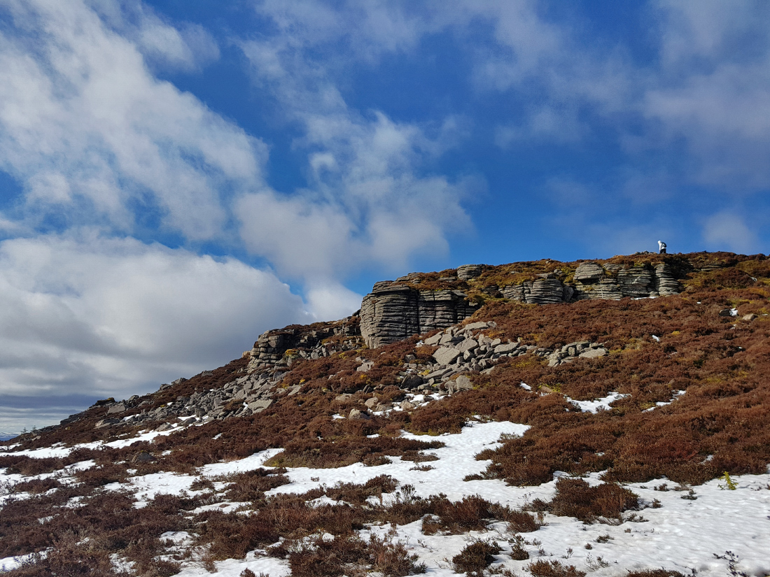
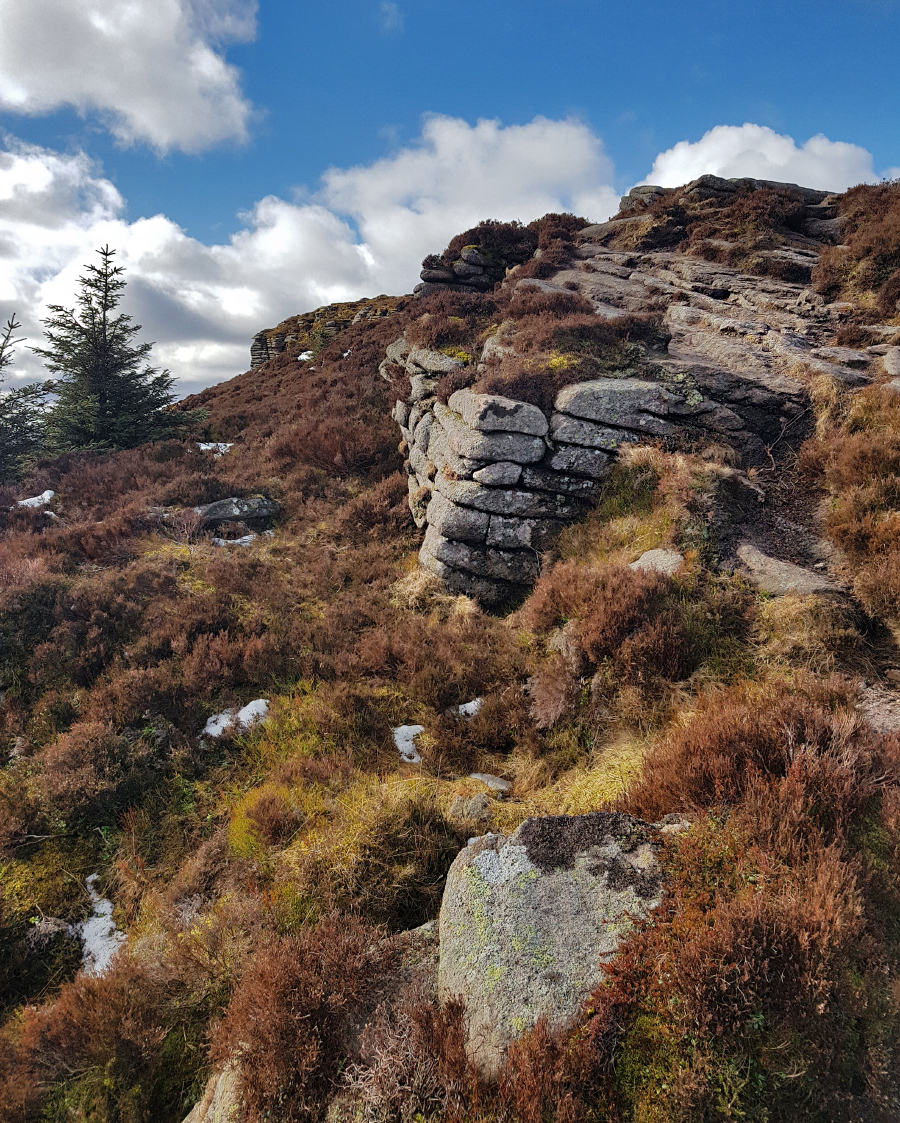
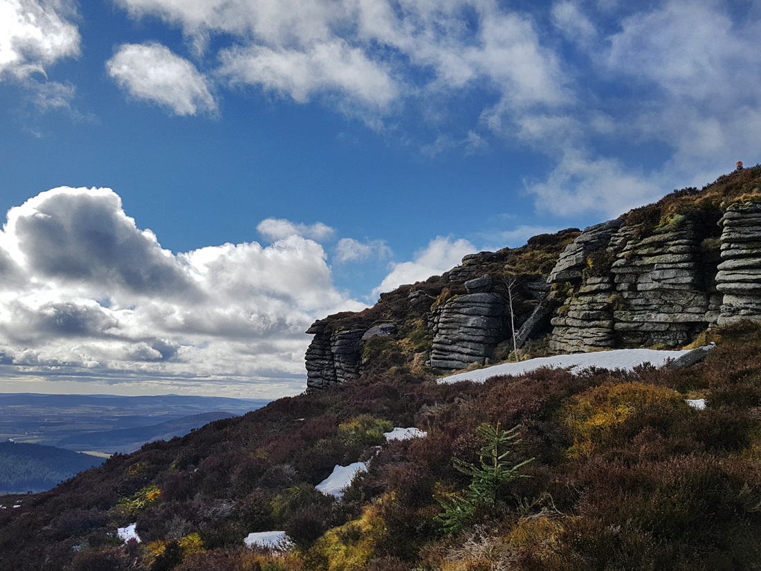
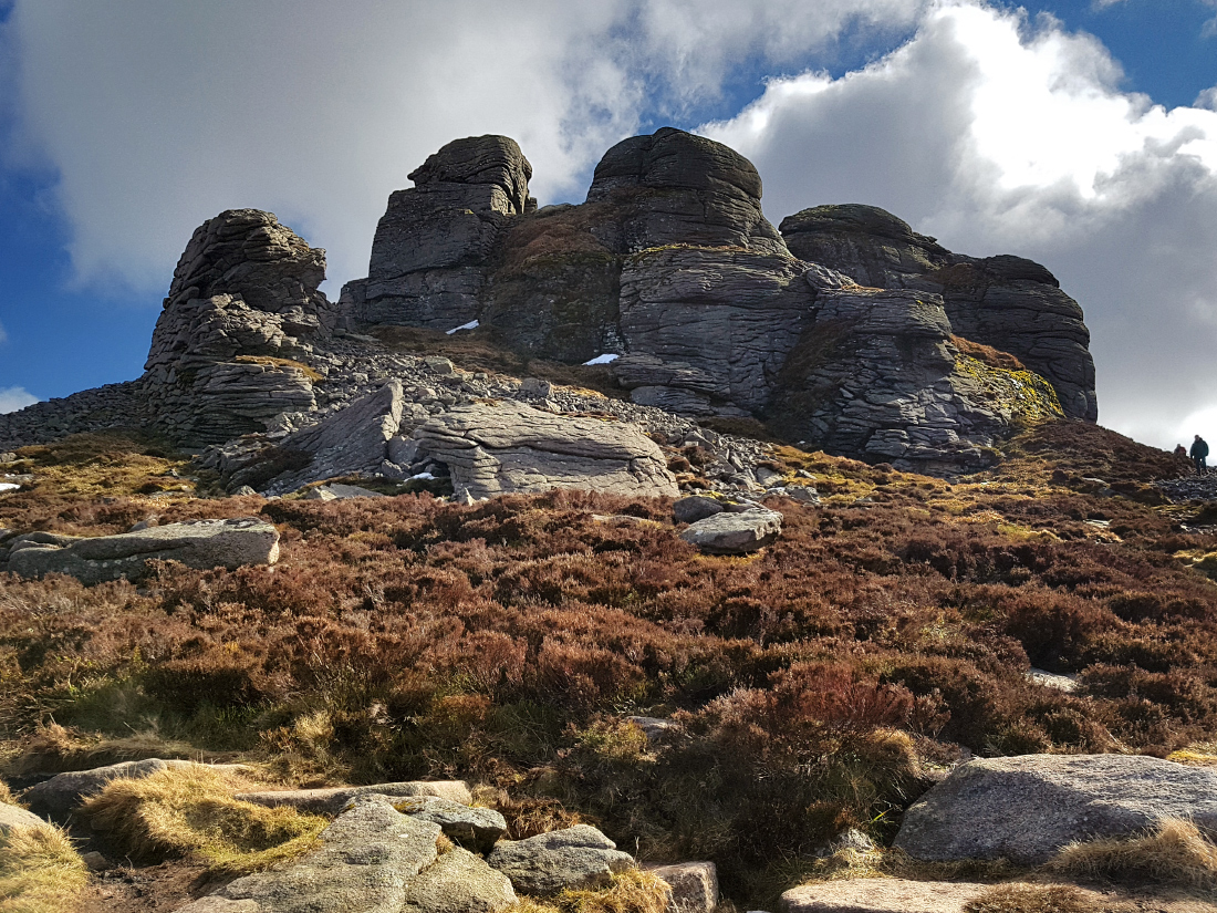
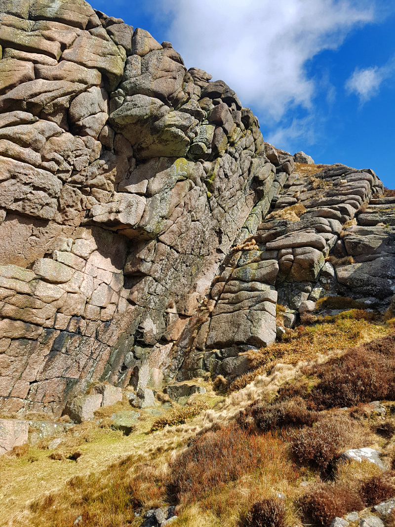
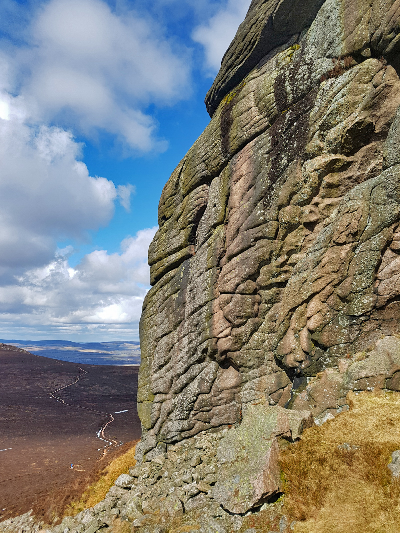
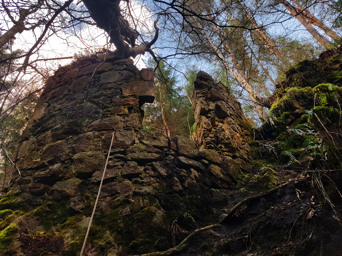
Craigshannoch means “hill of the foxes”; a fox could certainly make a good den in many of the nooks crannies and chambers afforded by the eroded strata in the tors. My second exploration target of the day lies here: Harthill’s cave.
From “Guide to Bennachie” by the late James R. Mackay:
“The last occupant of Harthill Castle, John Leith, was, like his forebears, head of the Leith clan, but he had fallen on evil days as he had flouted all authority. Visiting Aberdeen, he sat in the provost’s seat in St Nicholas Kirk, and was clapped in the tolbooth. His friends smuggled a musket into the jail, from which he took pot-shots at the bailies and other citizens! Escaping back to Harthill, he awaited his creditors and as they arrived to take possession of his furnishings he set fire to the castle, and climbing Craigshannoch to the tiny cave near to its top, watched Harthill burn. He was later executed in London. Harthill remained roofless for nearly three hundred years, until 1978, when the restoration of the castle was beautifully completed. The Craigshannoch cave and the fort on the Mither Tap were used as hiding places by the outlawed Lord Pitsligo after the rebellion of 1745. When on Bennachie he occasionally visited his friend General Horn at Logie Elphinstone and had a ‘night’s hard drinking’ with him. On the General’s wife protesting, Lord Pitsligo replied that ‘if she was sitting upon a caul bare stane up on Bennachie wi’ naethin’ but burn water, she micht ca’ that ‘hard drinkin.’”
I imagine if one had been sleeping amongst the rocks up on the hill, a hard night’s drinking would have been much needed.


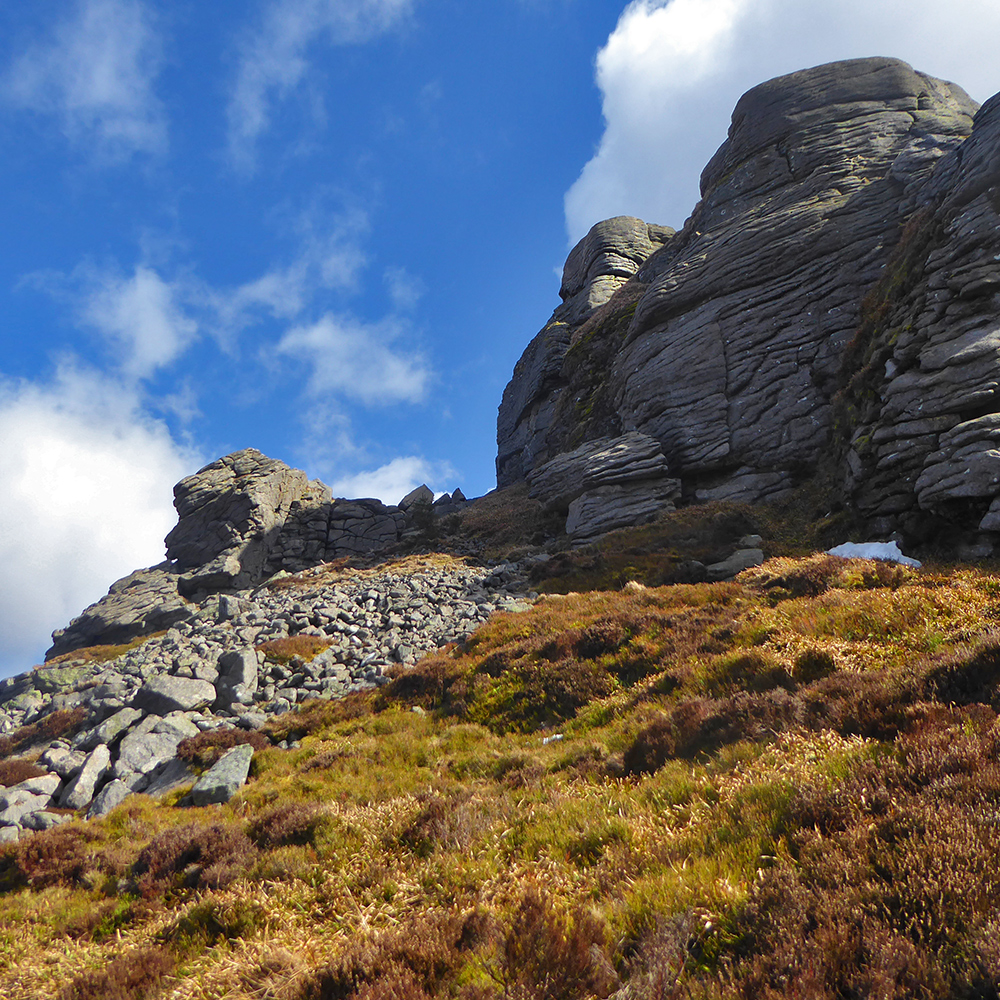
I proceeded to circuit around the tor, looking for nooks that may have led to a cave. There were plenty nooks but no sign of anything that that would have been large enough to shelter the half a dozen folk that I’d seen mentioned online.

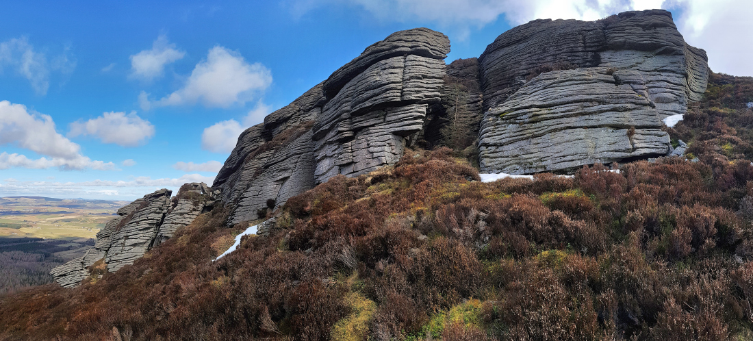

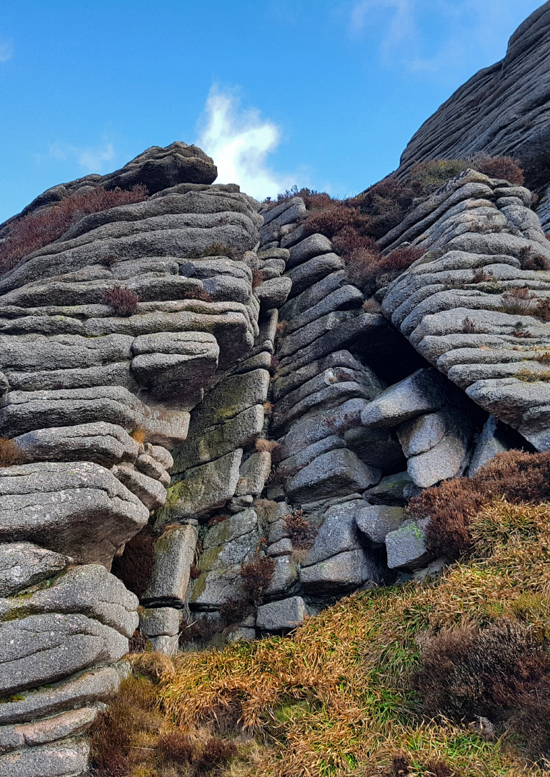
Retiring back to the top, lunch was taken, and a bit of googling revealed some further info that encouraged another circuit of investigation with some volunteers; but no sign. Another explorer, Linda, slipped and fell down a good few feet; fortunately entirely unscathed. If having a look, take care as the jumble of slippery rocks around here could easily inflict serious injury.


Another ‘almost but not quite a cave’
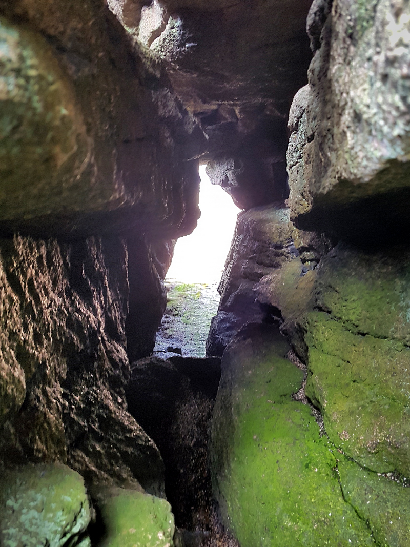
There was a further outcrop about 50m further downhill that was left unexplored, and yet more googling would indeed appear to show this is where the cave lay http://www.geograph.org.uk/photo/2907698
(note: I returned another time and found the cave, and stayed in it overnight)
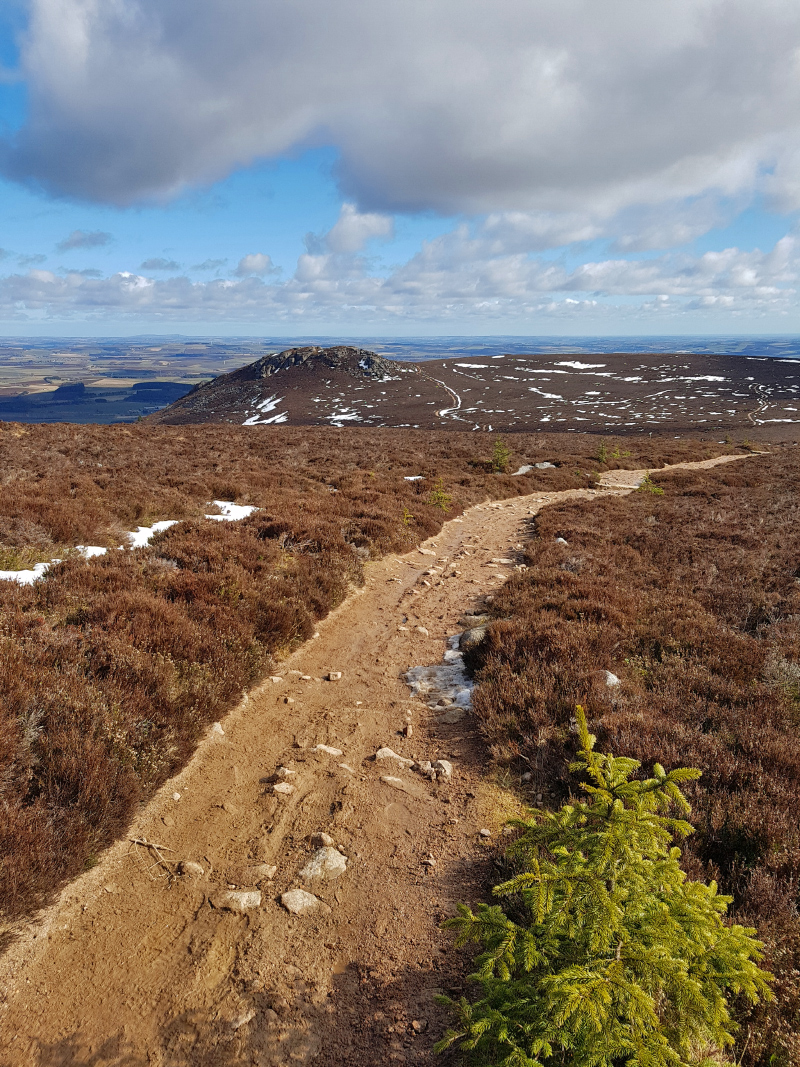
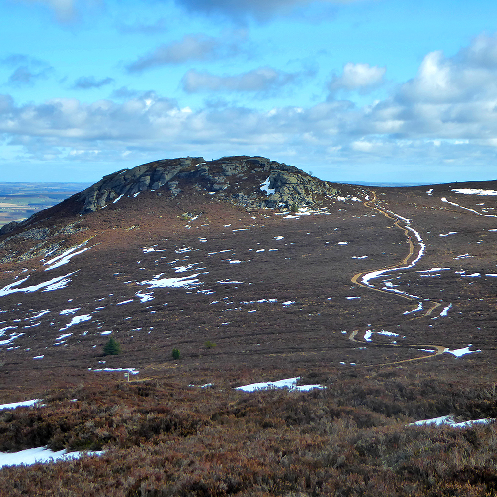
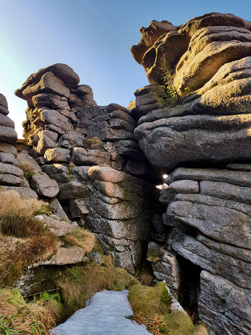
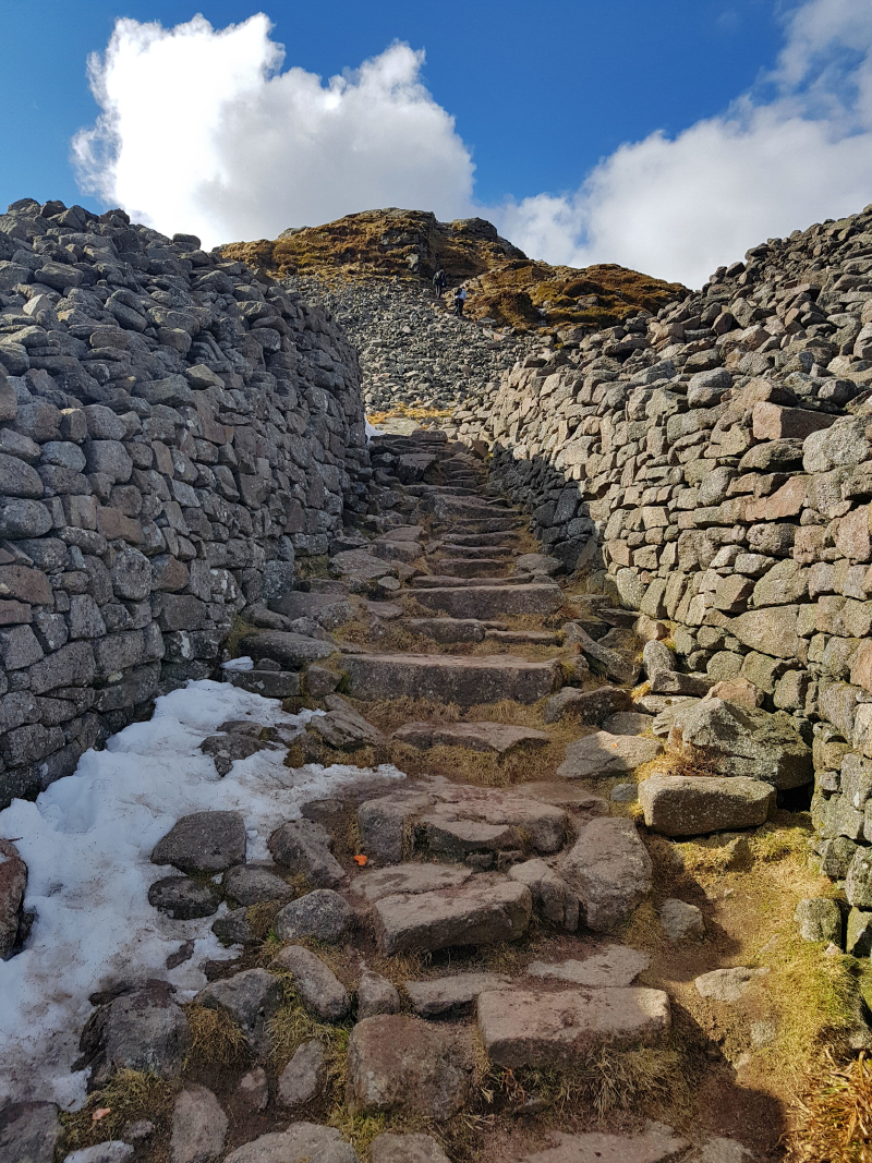
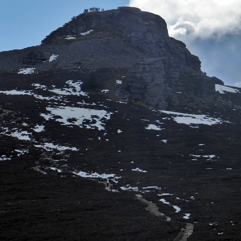
We headed onwards SE to the distinctive peak of Mither tap
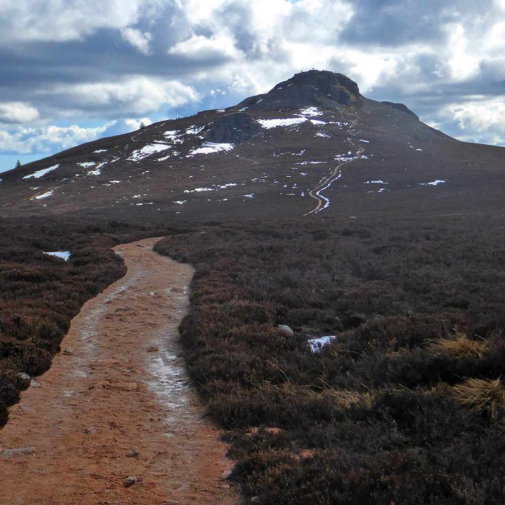
The path loops around left, but you can scramble up to the right

Up on top we mingled with the throng (a very popular destination on a good day)
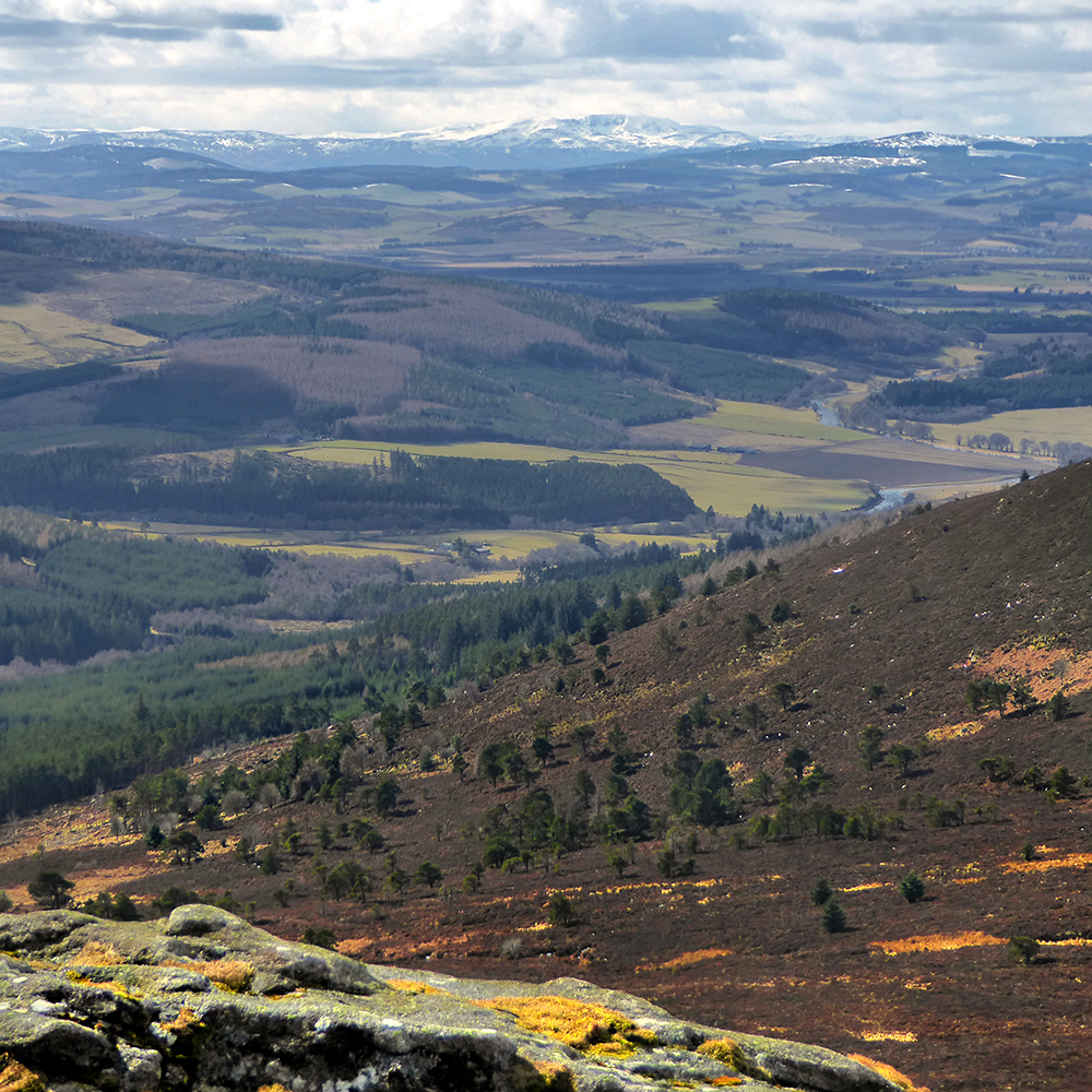
Looking towards Lochnagar
I think this gap might be known as ‘Jock O’Bennachies seat’ though I can’t find any reference to that online. Jock O’Bennachie is a giant of legend that hurled rocks between here and various other hills.
I notice a curious mark carved in the rock
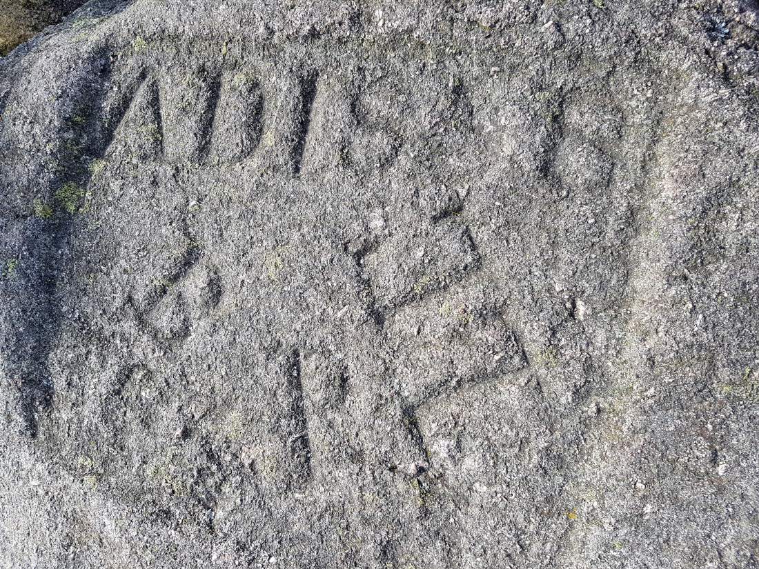
Latter investigation will infuriate me; another tale of the land stolen by the rich and powerful, and the poor inhabitants treated like dirt. Back in the 1800s, a small township of crofts sprung up on common land here. Through sweat and toil they made moorland into fields, and scratched a living. The neighbouring lairds, greedy for new land, stole the commonty land, to their ownership through court ruling (I imagine the crofters wouldn’t have even been aware or certainly wouldn’t have had the wherewithal to contest) and then evicted or charged the tenants rent. The carving, known as the “thieve’s mark” is a gloating stamp of the three estates involved – Balquhain, Pittodrie and Logie Elphinstone, with the date 1858 one year before the court approval such was their confidence.
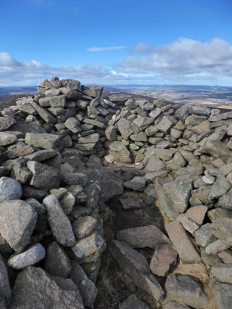
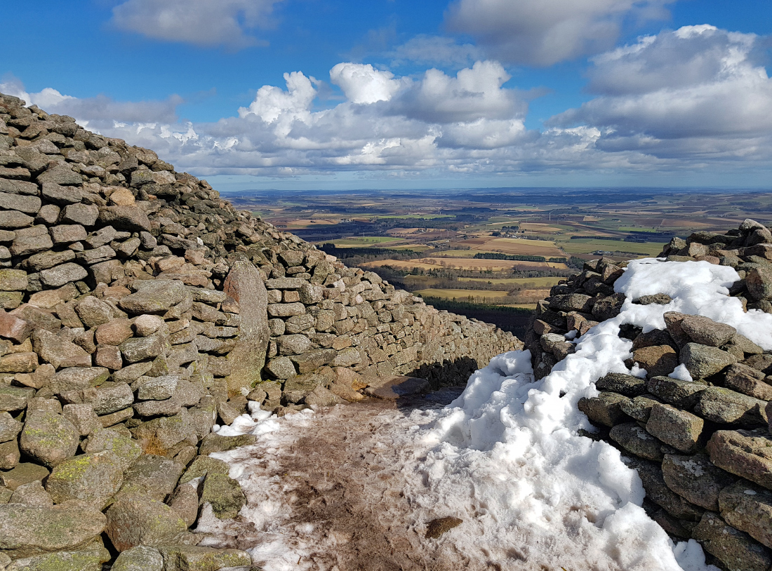
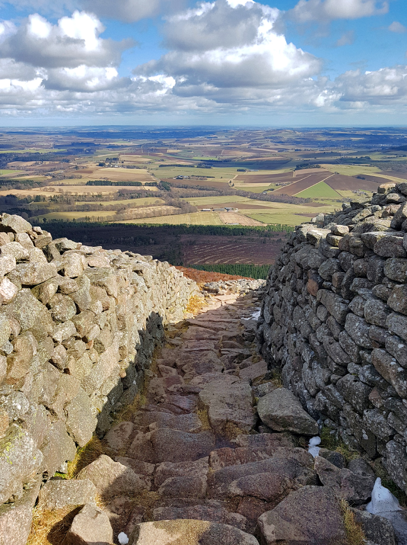
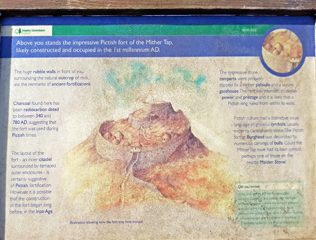
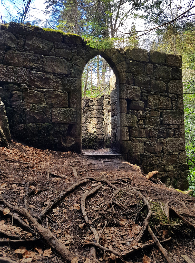
Further down from the peak you pass through the rock walls that are the remains of an iron age fort that must have been an impressive sight back in ancient times.
A lot of folk on top as we head down.
With the rest of the party taking the direct route down to the SE to the visitor centre, I head north along the ancient roadway, Maiden Causeway, part of the legend of the Maiden stone. I want to see if I can find the ‘Fog house’ a ruin with a waterfall beside it.
I pass near Hosie’s Well (NJ 681261) but lacking in time don’t stop to investigate.
“The Battle of Harlaw took place in 1411 on the sloping land to the west of Inverurie. Here the Earl of Mar and his men fought the Highlanders in a bloody battle. Hosie, a local man, was on his way to marry his bride when he was persuaded to fight in the battle instead, postponing his wedding. After the battle, he was imprisoned in a Hebridean dungeon for several years. Eventually he escaped and went to find his bride to be. While he was in prison she had married someone else.
Hosie was heartbroken, and with nothing to live for, he died and was buried on the hill overlooking Mither Tap. The well near where he was buried is called “Hosie’s Well” because it was believed that the water in the well is “nothing but Hosie’s tears”.”
Heading down into the woods, there are a few unmapped paths heading South. There’s a ‘private’ sign, no doubt struck up before the right to roam; good luck with that.
A wrong turn or two into the woods from the turnpike eat into the time, but hey, it’s all good shinrin yoku
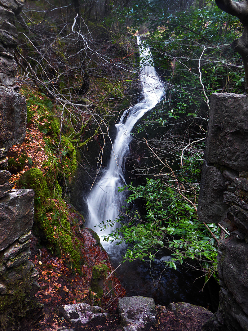
I’m under the misapprehension that a ruin called Bede house is where the target is, and deep in the woods clattering through the undergrowth I burst into the clearing there (there’s no ruin, just a clearing..this can’t be it). A chap pootling with a metal detector gets a fright, and makes off to avoid my rude intrusion into the glade’s peace; I ask him if he knows of the waterfall; and satisfied I’m only partially crazy, explains exactly how to get there: can’t beat local knowledge, a lucky encounter.
There’s an old wall that I could follow directly South but best to get back to the track and then follow the South side of the Rushmill Burn upstream. As instructed, I follow the faintest path along the burn through dense forest. Hidden in a gully and round a bend, you can only see (or hear) it from nearby; I’d definitely not have found this without his help.
Here we go

According to the Concise Scot’s Dictionary : “Fog House; small garden summer house lined (or possibly roofed) with turf”
Perched over the burn
From BoB : “Also from Standing on the banks of the Rushmill Burn below the Linn (waterfall) in a semi ruinous state, due partly, according to the Banffshire Journal dated Aug 1864, under the heading of Bennachie and Excursionists “they broke the windows, and took the door off the hinges, and, throwing the furniture into the burn below, left it in a ruin!”.
According to McConnachie “Bennachie” 1890, the Fog House was built “a good few years ago”
Why anybody would want to wreck it is unknown: though as it first appears on a map in 1870, not long after its likely owner, the nearby Pittodrie house, was party to the theft of the Bennachie commonty may be ample cause. On one hand, I’d like to think there was an element of retribution against the greedy behaviour of the estate; on the other it’s a shame such a finely placed wee hoosie beside a waterfall was broken.
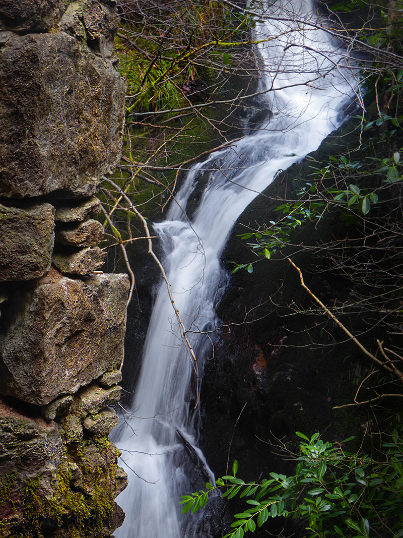
You can just about slip around the side to the foot; perhaps a wade might produce an interesting view point. Not today with the clock ticking, and freezing snow melt coming off the hill!

[note 2022: the entire area around the fog house is inaccessible currently due to fallen trees from the storm earlier in the year]
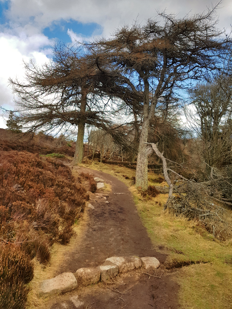
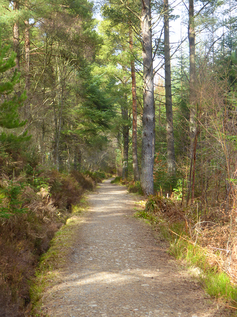
I’ve now lingered in this green oasis a while too long; time to get back on the Turnpike path and give it some running laldy lest I miss the 2.30 bus deadline. Fortunately the path is ideal running. My swift feet, tap out a beat, and eat pine fresh komerebi
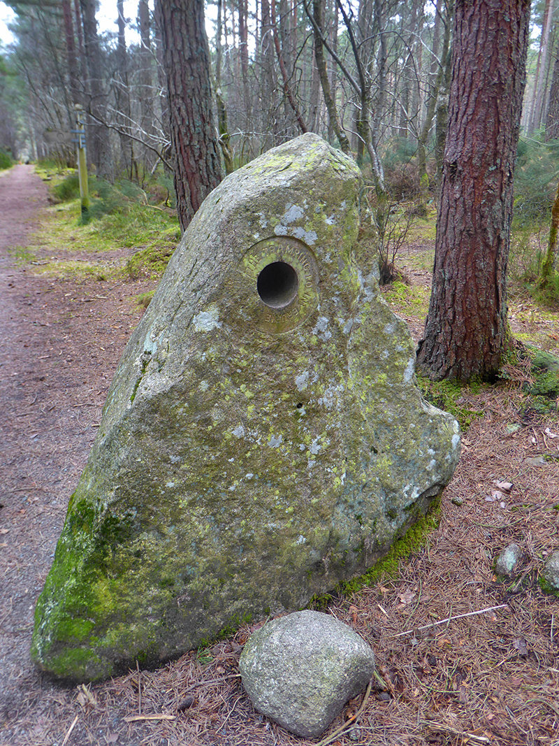
Nearing the visitor centre, I happen across a sculpture of sorts; partially placating my earlier fail
Almost at the centre, I spot this fine totem pole

“This pole was carved by first nation people from British Columbia (Squamish nation) in 2002 as part of Forestry Commission Scotland’s Treefest 2002 celebrations. The carved pole is a Douglas fir donated by Balmoral Estate. There are three other totem poles that were created in the same year from the same tree, these can be found at Coluqohhine Hotel, Bellabeg , Strathdon and Chapel of Garioch Primary Schools. Each pole was carved by local people with help from the first nation carvers using local designs and legends.”
At the bus right on time, and we’re off to the Bennachie lodge for a pint. A fine quick outing, and plenty left of Bennachie to explore the next time I’m out here.
Another useful guide/map: https://www.discoveringbritain.org/content/discoveringbritain/walk%20booklets/Bennachie%20walk%20-%20written%20guide.pdf
Another Bennachie visit in 2020 https://moab.in/bennachie-overnight-tour/
Hi can you help me please, we stay in Inverurie and walk a lot, we are desperate to fine the fog house and water fall, we were up Roman tree walk today however didn’t know what path to take to find the fog house. Can you please advise me on what side to find it.
Hi Marion – I’ve made a small map with a description, hope this helps
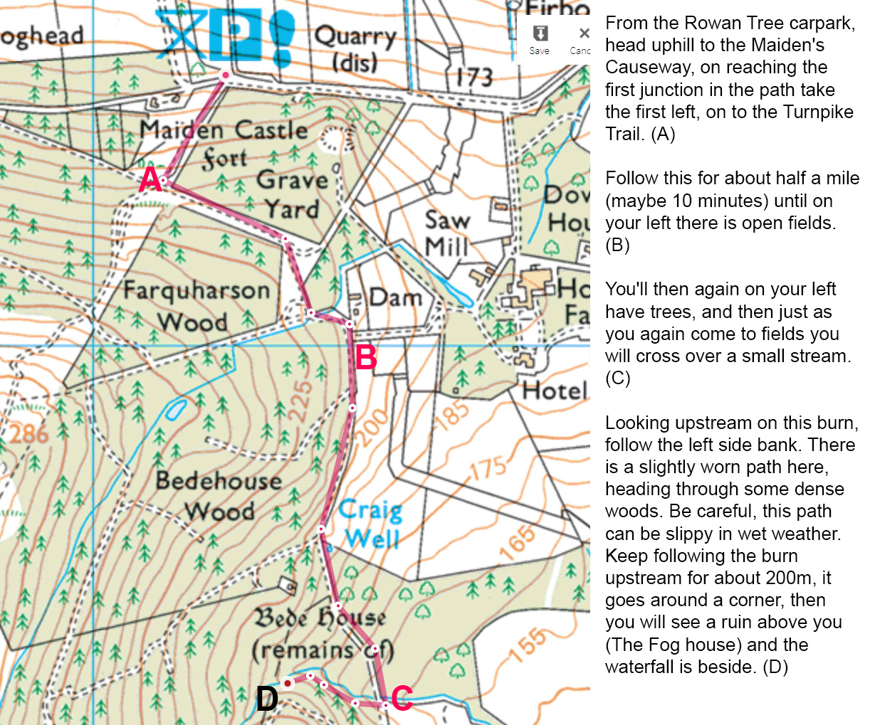
An update in 2022: the path between C and D is inaccessible due to the area all around being covered in dozens of fallen trees from storms earlier in the year. It’s unknown if the Fog house survived unscathed.
Is the Three Celtic Kings art installation near to the cairn remains on Knockollochie summit?
Hi Elaine, yes right on the top of the hill. I haven’t been back there since my visit in 2018 so hopefully the sculptures have survived the storms in recent years, from what I recall there are trees quite near to them, although being made of metal and concrete should have survived ok.